


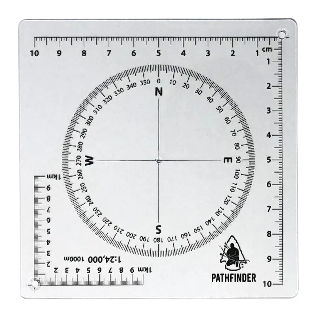
This tool allows you to plot grid coordinates on two different scales of maps. Also included a compass rosette for plotting routes through specific azimuth. This is the exclusive tool used to teach map reading at The Pathfinder School.
Scales:
- 1:24,000
- 1:10,000


 GEN 2 EDC Sleeve Combo")


